


9 Best Hikes in McDowell Sonoran Preserve for Every Skill Level

By: Adam Jerold Cansino | August 20, 2026
Scottsdale is surrounded by remarkable Sonoran Desert scenery, and the McDowell Sonoran Preserve offers visitors everything from short interpretive walks to demanding climbs with panoramic views. The Preserve includes northern and southern recreation areas connected by an extensive network of multi-use trails, offering options for beginners, families, regular hikers, and experienced outdoor enthusiasts.
This list covers nine routes with different distances, terrain, and difficulty levels. Before heading out, check current conditions and official maps, especially during Scottsdale’s warmer months. The City recommends starting before 10 a.m. or after 5 p.m. during extreme heat and carrying essentials such as water and sun protection.
If you are building a larger Arizona itinerary, pair your outdoor day with the ideas in 10 Best Things To Do in Scottsdale, Arizona for an Unforgettable Desert Getaway.
Easy Scottsdale Desert Routes for Beginners
1. Bajada Nature Trail: Best for Beginners and Families
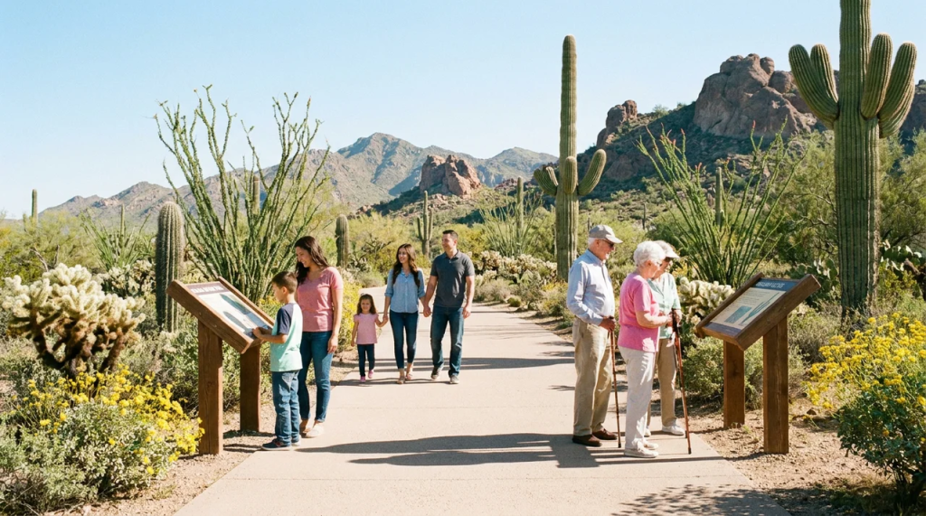
For an approachable introduction to the Sonoran Desert, start at Gateway Trailhead. The Bajada Nature Trail is approximately 0.5 mi and was designed so children, older visitors, wheelchair users, and people with other physical challenges can experience the Preserve. Its stabilized decomposed-granite surface and interpretive features make it especially useful for first-time visitors who want scenery without a strenuous outing.
This is also a smart choice if your Scottsdale itinerary already includes other active experiences and you just want a short morning outdoors.
Best for: families, beginners, accessible outdoor experiences, and short visits.
2. Horseshoe Loop: Best for an Easy Scenic Walk
From Gateway, Horseshoe Loop combines several connected paths into an easy 1.7-mi route with roughly 100 feet of gain. The landscape includes saguaros, desert shrubs, trees, birdlife, and views toward the surrounding hills. The official route reconnects through Saguaro Trail before returning to the parking area.
It offers more distance than Bajada while remaining relatively gentle, making it a good introduction for travelers seeking a traditional Scottsdale desert outing without a major climb.
Best for: casual walkers, families, birdwatchers, and first-time desert visitors.
3. Fraesfield Loop Hike: Best for Rolling Desert Scenery
The Fraesfield Loop Hike follows Whiskey Bottle, Turpentine, and Black Hill routes through the northern Preserve. It covers approximately 4.7 mi with about 300 feet of gain and passes washes, seasonal vegetation, and the northeastern side of Fraesfield Mountain. The Conservancy suggests allowing around three hours.
This area feels different from the Preserve’s steeper southern portion. The northern region generally features compacted soil, crushed granite, sandy washes, rolling terrain, and more moderate climbs.
Best for: casual hikers ready for a longer outing, nature lovers, and visitors seeking quieter scenery.
Moderate Routes With Scenic Mountain Views
4. Ringtail Loop: Best for Variety Without a Major Climb
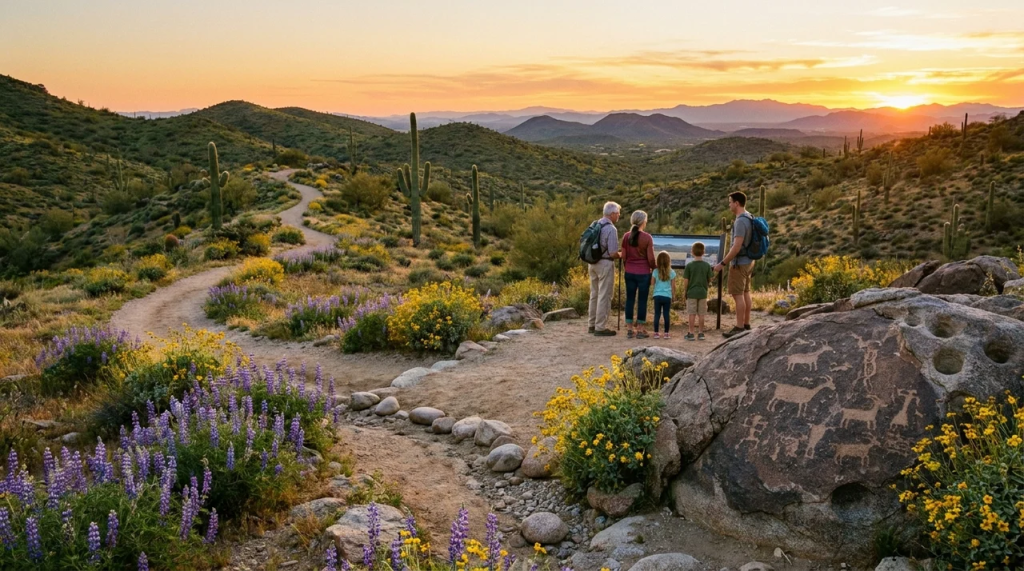
Starting from Lost Dog Wash Trailhead, this 2.4-mi loop features gradual ups and downs, wash crossings, seasonal wildflowers, and views from the overlook. The official description calls it gentle overall, though it includes several moderate sections.
One particularly interesting feature is evidence of prehistoric tool-making near the overlook. That mix of scenery, archaeology, and manageable terrain appeals to travelers who want more than a nature walk without committing to one of Scottsdale’s steepest climbs.
Best for: intermediate beginners, families with outdoor experience, and history-minded visitors.
5. Granite Mountain Scenic Hike: Best for Rock Formations
This northern Preserve outing begins on the Bootlegger Trail, then connects to the Granite Mountain Loop and continues to a scenic viewpoint. The official itinerary covers about 3 mi and gains less than 200 feet. From the viewpoint, hikers can look across the Verde River Valley toward the Mazatzal Mountains.
The surrounding area features crushed-granite terrain, dramatic rock formations, wildflowers, and large saguaro stands. The trailhead has parking, restrooms, and shade, but no drinking water is available there.
Best for: photographers, geology enthusiasts, wildflower trips, and scenic outings.
6. Gateway Loop: Best All-Around Scottsdale Experience
The Gateway Loop trail is one of the Preserve’s classic moderate outings. The route covers approximately 4.5 mi with around 650 feet of gain, climbing toward a low saddle before winding back toward Gateway. Official guidance classifies it as moderately difficult because of its length and changing grades.
Wildflowers, wildlife, saguaros, and elevated views create a strong introduction to the Scottsdale landscape. Children with prior outdoor experience may also complete it, but families should assess conditions and individual abilities before setting out.
Best for: active visitors, intermediate hikers, couples, and travelers with time for only one Preserve outing.
7. Taliesin Overlook: Best for Architecture and Desert Views
This gentle out-and-back starts in the same eastern Scottsdale area and crosses several washes before reaching an overlook above Frank Lloyd Wright’s Taliesin West. The official route is approximately 4 mi with about 450 feet of elevation gain.
The combination of wilderness scenery and views toward one of Scottsdale’s best-known architectural landmarks makes this an especially interesting choice for visitors who want more than a purely fitness-focused outing.
Best for: architecture lovers, photographers, couples, and visitors interested in Taliesin West.
Challenging Scottsdale Routes for Experienced Hikers
8. Sunrise Trail East: Best for Summit Views
Sunrise Trail East is one of the Preserve’s more difficult options. Beginning at Sunrise Trailhead, the approximately 4-mile out-and-back climb gains about 1,150 feet on its way toward Sunrise Peak. From the top, hikers can take in broad views across the McDowell Mountains and surrounding granite formations.
This route suits conditioned visitors who are comfortable with sustained uphill sections. It can also appeal to travelers seeking a workout without choosing one of the system’s longest routes.
Best for: fit hikers, summit seekers, sunrise outings, and visitors comfortable with steep terrain.
9. Tom’s Thumb Lookout Viewpoint: Best for a Challenging Adventure
For a demanding outing with a significant payoff, consider the Lookout Viewpoint from Tom’s Thumb Trailhead. The official route is approximately 5.1 mi and gains around 1,000 feet, with steep, loose, narrow, and rocky sections along the way.
The Tom’s Thumb Trail traverses varied geology before reaching expansive viewpoints over the McDowell Mountain Range. The trailhead offers parking, restrooms, shade, and interpretive signage, but no drinking water, so arrive prepared.
Experienced visitors wanting an even bigger challenge can research the East End Loop, which the Conservancy describes as an extremely difficult 11.1-mi outing with multiple major climbs.
Best for: experienced hikers, fitness-focused travelers, photographers, and those seeking a challenging outdoor adventure.
How to Choose a Trailhead in Scottsdale
The right starting point depends on your ability level, preferred scenery, and how much time you have.
Gateway works well for travelers who want multiple route options from a single developed access point. It offers parking, restrooms, shade, drinking water, interpretive information, and accessible recreation. Tom’s Thumb provides access to more rugged terrain, while Fraesfield and Granite Mountain open into the Preserve’s northern landscape.
Before leaving your accommodation, review official trailhead locations and download the appropriate regional map. Conditions in Scottsdale can change substantially with the season, and summer temperatures require particularly cautious planning. The Preserve is open daily from sunrise to sunset, and individual access points follow seasonal opening and closing times.
Plan Your Scottsdale Hiking Getaway
A morning in the Preserve pairs naturally with Scottsdale’s restaurants, spas, shopping districts, golf courses, and cultural attractions later in the day. Visitors staying several nights can also choose an easier route first and save a more demanding outing for another morning.
For groups and families who want more space between adventures, explore Scottsdale vacation rentals from Paradiso and choose a home base that fits your itinerary.
No matter which route you choose, stay on designated paths, respect wildlife, pack out what you bring in, and choose an outing that matches your experience and the day’s conditions. The Conservancy specifically asks visitors to protect fragile desert surfaces, yield appropriately to other users, and leave natural and cultural features where they find them.
Frequently Asked Questions
Which route is easiest for beginners?
Bajada is one of the most approachable choices because it is short, hard-surfaced, interpretive, and designed to accommodate a broad range of visitors. Horseshoe Loop is another good option for people who want a little more distance without a steep climb.
Which option has the best views?
That depends on how much effort you want to put in. Gateway offers excellent scenery at a moderate difficulty level, while Sunrise Peak and the Tom’s Thumb Lookout provide broader viewpoints for visitors comfortable with steeper terrain.
Is the McDowell Sonoran Preserve free to visit?
Yes. The City of Scottsdale says the Preserve is open daily from sunrise to sunset and is free to visit.
When is the safest time to go during hot weather?
During periods of extreme heat, Scottsdale recommends arriving early and hiking before 10 a.m. or after 5 p.m., choosing shorter routes, using sun protection, and carrying appropriate supplies.
How do I decide how far to go?
Consider the weather, fitness, terrain, available daylight, and everyone in your group’s abilities. Compare official route maps before you leave, and remember that a 4-mi round trip with steep climbing can feel much harder than the same distance on flatter terrain.