


Blue Ridge Parkway Scenic Drives Near Asheville

By: Adam Jerold Cansino | November 9, 2026
The hills around Asheville offer some of the most rewarding scenic drives in the southern Appalachians. The Blue Ridge Parkway follows elevated ridgelines, passing wide overlooks, historic sites, and changing forest scenery. You can enjoy a gentle drive from the city or plan a longer outing with stops at Craggy Gardens, Mount Mitchell, Mount Pisgah, and Graveyard Fields.
These routes work for couples, families, and photographers because many views are available from designated parking areas. Follow the official National Park Service closure updates before leaving: repair projects after Hurricane Helene, freezing weather, and temporary restrictions can change which sections are accessible.
Why the Parkway Is Worth Exploring
The scenic highway extends 469 miles through Virginia and North Carolina. Unlike an interstate, it is designed for slow sightseeing rather than fast travel. Some bends reveal distant mountain peaks, while others pass beneath hardwood trees. Views change with elevation and season, so even a familiar stretch feels different each visit. The Parkway follows contours across several mountain ridges, creating a series of mountain viewpoints instead of a single lookout. On a clear day, the highland landscape changes color as the sun moves across the valleys.
The Parkway also offers a practical introduction to western North Carolina. Stop for photographs, visit craft galleries, or add a short hike. Pair a day of sightseeing with the 15 best things to do in Asheville, NC, including museums, the Biltmore Estate, and regional attractions.
To plan an outing, start at the Parkway’s central area near mile 384. Craggy Gardens is roughly 20 miles away at mile 364, while Mount Pisgah is about 24 miles south at mile 408. These figures describe the route between markers, not travel from a particular rental property. Allow extra time for curves, parking, and overlooks instead of measuring the trip only by distance.
1. Craggy Gardens: Wide Views and Rhododendron Blooms
Location: Mile 364, north of Asheville
Allow: About two to three hours for a relaxed round trip, depending on your starting point
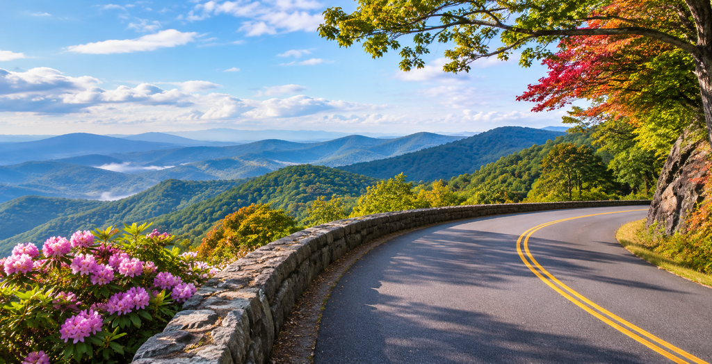
Craggy Gardens offers some of the area’s most striking high-elevation mountain views. This section of the Parkway sits above nearby valleys, so mountain weather can differ sharply from conditions downtown. A winding approach passes tunnels and rugged slopes before reaching lookout areas framed by distant Blue Ridge peaks.
Late spring and early summer bring rhododendron blooms; fall brings colorful leaves across the ridges. On a clear day, visitors can photograph several layers of the Appalachians without a strenuous walk. The Craggy Pinnacle trail provides an additional viewpoint when open.
According to the National Park Service, Craggy Gardens is 18 miles north of the Folk Art Center. The Parkway viewpoint areas can be foggy in the morning, while distant summits may become visible later. The drive between these places typically takes about half an hour without long stops, although traffic and visibility can change that. Check the seasonal schedule for the Craggy Gardens facility; its picnic area and some nearby recreation routes have had storm-related closures.
Best for: Couples, photographers, spring flowers, and a shorter excursion.
2. Mount Mitchell: A High-Elevation Day Trip
Location: Mile 355.4, on the approach from Asheville
Allow: Half a day for sightseeing and time at the summit
Mount Mitchell rises to 6,684 feet, making it the highest peak east of the Mississippi River. The drive approaches the state park through a landscape where vegetation and temperatures differ from those in town. From the observation area, clear weather can reveal an expansive series of peaks and valleys.
Mountain temperatures at the summit are often cooler than in Asheville, even in summer. This Parkway outing shows how quickly the high-altitude environment can change. Bring an extra layer and be prepared for fog that can hide the view. This stop is especially rewarding for visitors who want a signature mountain experience without adding a long walk.
Access note: The National Park Service’s November 2026 status page lists the section from mile 344.2 to mile 355.3, on the north side of Mount Mitchell, as closed for Helene recovery. The approach from the south is listed as open, but verify the latest status and state park conditions before departing. Do not assume a continuous connection from Little Switzerland.
Best for: High viewpoints, natural history, and a half-day outing.
3. Folk Art Center: Crafts and an Easy Parkway Stop
Location: Mile 382, east of central Asheville
Allow: One to two hours
The Folk Art Center combines Appalachian craftsmanship with an easy sightseeing stop. Its Southern Highland Craft Guild galleries feature traditional and contemporary work, and it offers demonstrations on selected dates.
This is a useful Parkway stop when mountain weather limits longer excursions. Visitors staying near Asheville can combine the galleries with a shorter afternoon of sightseeing. Nearby overlooks let visitors combine an indoor attraction with time outside. A little farther along, the Blue Ridge Parkway Visitor Center near mile 384 offers maps and interpretive information; confirm opening hours before visiting.
Families can enjoy the galleries without committing to a full-day itinerary. For an extra experience, return to Asheville for dining or another cultural attraction instead of trying to cover too many miles at once.
Best for: Families, art lovers, and first-time visitors.
4. Mount Pisgah: A Peaceful Southern Route
Location: Mile 408, south of Asheville
Allow: Two to four hours
Mount Pisgah offers mountain scenery, broad overlooks, and places to stop at your own pace. The Parkway climbs through forested slopes, with changing views of the mountain landscape around each bend. It sits roughly 24 miles south of the main Parkway visitor area, making it a manageable outing when the connecting segments are open.
The summit hike is steep, so visitors seeking an easy experience can choose roadside viewpoints instead. Pisgah Inn provides seasonal dining and lodging, while the nearby campground has separate operating dates. Check both facilities before planning a meal or camping stay.
The surrounding forest is particularly attractive in fall, when the mountain slopes turn gold and red. On this section of the Parkway, short hiking excursions are optional, not essential. On warmer days, higher elevations often feel cooler than Asheville streets. This section works well for travelers who prefer a flexible drive with fewer scheduled activities.
Best for: A quiet afternoon, photography, and optional outdoor recreation.
5. Looking Glass Rock and Graveyard Fields: Scenic Southern Stops
Location: Miles 417–419, south of Asheville
Allow: Half a day or more
Traveling beyond Mount Pisgah reveals a super-scenic stretch of highland scenery. This section of the Parkway crosses changing mountain terrain, with views into forested valleys. Looking Glass Rock Overlook provides views toward the enormous granite formation rising above Pisgah National Forest. Graveyard Fields, near mile 419, offers a very different landscape of open vegetation, streams, and waterfall scenery.
The two attractions are only a few miles apart, which makes them a practical pairing. Visitors can take in the views from parking areas or add a more active excursion when paths are open. Because these are popular stops, arriving early is useful on fall weekends.
For travelers comparing road trips around Brevard, this southbound route also lets you enjoy the upper elevations before exploring attractions reached by connecting highways. Check for weather changes, particularly when clouds or fog reduce visibility.
Best for: Photography, a longer drive, and varied landscapes.
6. Black Balsam: Open Ridges and Wide Horizons
Location: Mile 420, south of Asheville
Allow: Several hours, including time outdoors
Black Balsam is known for grassy balds and broad mountain views rather than densely wooded slopes. The nearby Parkway offers a starting point for hiking, but weather on exposed ridges demands extra care. The exposed terrain provides a striking perspective across the Blue Ridge region, especially when visibility is clear.
Forest Service Route 816 reaches nearby recreation areas when open. Because this access route is managed separately, an open Parkway segment does not guarantee you can reach every adjoining destination. Check restrictions before setting out, and avoid exposed areas during thunderstorms.
This stop is a good choice for experienced outdoor visitors who want a longer outing. Those who prefer to stay close to the vehicle can still appreciate the scenery from suitable designated viewpoints.
Best for: Experienced walkers, photography, and open highland views.
Plan a Short or Full-Day Blue Ridge Parkway Drive
A useful itinerary follows one direction, with a few well-chosen stops rather than a race across the entire region. Parkway travel rewards patience, especially when a mountain overlook deserves more time.
| Time available | Suggested route | Best for |
| 1–2 hours | Folk Art Center and nearby overlooks | Families and an easy introduction |
| 2–4 hours | Craggy Gardens and nearby viewpoints | Couples and photographers |
| Half day | Mount Pisgah and optional picnic stops | Relaxed sightseeing |
| Full day | Mount Pisgah, Looking Glass Rock, and Graveyard Fields | Outdoor enthusiasts |
For a northbound trip, allow time to enjoy Craggy Gardens before considering Mount Mitchell. For a southern trip, the distance from mile 408 at Mount Pisgah to mile 419 at Graveyard Fields is about 11 miles along the Parkway. Travel can be slower than expected because of curves and visitor stops.
You can build an optional loop using open connecting highways, but do not rely on unsigned shortcuts or closed sections. A longer excursion toward the Linn Cove Viaduct near Grandfather Mountain belongs on a separate day: it is much farther north than the destinations in this guide.
Best Seasons for Blue Ridge Parkway Scenic Drives
Spring brings fresh greenery and wildflowers, although mountain elevations can still freeze. Parkway access is seasonal in practice, even when individual facilities have published hours. Summer offers long daylight hours and generally comfortable temperatures at higher elevations, though afternoon thunderstorms are possible.
Fall is especially popular for foliage. Colors change at different elevations, so an early October visit may look different from one later in the month. Winter can be beautiful but often brings ice-related closures; never assume a route open last weekend will remain open today.
To plan around changing conditions, keep one alternative activity in town. You might pair a short Parkway outing with an afternoon at Biltmore, for example, or explore restaurants and galleries if fog obscures the views.
Safety and Access After Hurricane Helene
The National Park Service posts changes for individual Parkway segments, and a listed opening does not guarantee that adjoining picnic areas or recreation facilities are available. Check the official road status before you leave. Download maps before leaving; cellular coverage is inconsistent in some higher areas.
Fill the tank outside the Parkway, carry drinking water, use designated pullouts, and give yourself time to return before dark. The road has limited services and some stretches pass through remote mountain terrain. The road’s posted speed limits and sharp bends matter more than the distance shown on a map. If severe weather develops, choose a lower-elevation alternative rather than continuing toward exposed viewpoints.
Where to Stay for an Asheville-Area Getaway
A comfortable base makes it easier to enjoy different outings over several days. Families may value separate bedrooms and shared living space, while couples might prefer a private cabin for a quiet evening after sightseeing.
Paradiso Homes features Asheville vacation rentals in the surrounding region. Compare each property’s actual address with the entrances you intend to use; homes described as Asheville-area stays may be in neighboring communities rather than inside city limits.
Discover More of Western North Carolina
The Parkway makes an excellent centerpiece for an Asheville-area getaway, whether you have a morning or a full day. Enjoy the mountain views at a measured pace. Choose a few stops, leave room for unexpected views, and let current conditions guide your route. The best experience is rarely the one with the most destinations; it is the one that gives you time to appreciate each landscape.
Frequently Asked Questions
Which overlook is best for a first visit?
Craggy Gardens is a strong option for sweeping views without a long drive. Mount Pisgah works well for visitors who prefer a southern approach and several stops.
How much time should I allow?
A short drive may take one or two hours, while a longer trip with photography stops can fill half a day. Add more time if you want to hike or visit museums and craft galleries.
Can I visit Mount Mitchell after Hurricane Helene?
The Asheville side was listed as open on the November 2026 NPS status page, but the section immediately north remained closed. Confirm road and park updates before you go.
Is the Parkway free to use?
Yes. There is no general fee to use the scenic highway, though special services and some separate attractions may charge admission.
Can I enjoy the scenery without hiking?
Yes. Many viewpoints have designated pullouts close to the vehicle. Choose stops that suit your group’s mobility needs, and confirm access for each facility.